Fifty acres of land in and around Whittlesey, Cambridgeshire, are being recommended for approval for more than 400 homes. Two applications come before the planning committee of Fenland District Council next Wednesday. Officers recommend both are approved.
Application one is for 175 homes south of 250 Drybread Road, Whittlesey, with the applicant being Alison Homes Ltd.
The second is from Rose Homes (EA) Limited for 249 homes north of 271-311 Eastrea Road, Whittlesey.
Whittlesey town council is recommending the committee refuses both applications.
Of the Eastrea Road site the town council says it is “the last area of open land between Whittlesey and Eastrea which allows the separation of settlements, meaning open fields would be lost”.
The town council accuses planners of ignoring the approved Whittlesey Local Plan “which forms part of the FDC planning process which has recommended that this site should not be developed.
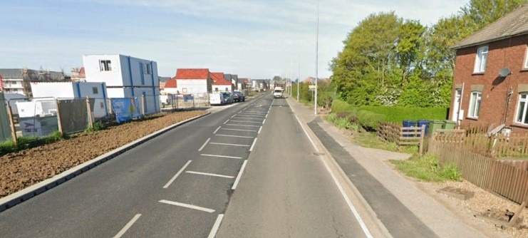
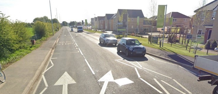
“Highways issues already have been identified with an additional 200 homes, and since the opening of the Aldi store the road has become more dangerous.
“A proposed roundabout was not agreed when Aldi was built, and an additional junction will cause more issues and be a safety hazard”.
The town council says residents turning right out of the proposed development onto the A605 “will not be safe and this new junction will not be workable”.
The town council says Whittlesey councillor and FDC leader Chris Boden “abstained from the vote, all other members voted in favour of refusal”.

Cllr Boden may have abstained from voting at town council, but in a strongly worded letter – published on the FDC planning portal – he lists his reasons for believing the application should be refused.
“The area involved is the final undeveloped site fronting the A605 in the Whittlesey area,” he says.
“It forms an important part of the separation of Eastrea village from the settlement of Whittlesey.
“If this site is built on it will materially affect the ‘market town’ feel to Whittlesey as it is the final residual open undeveloped area along the A605 before the border (along Drybread Road) with the village of Eastrea.
“The local desire to maintain as much as remains of the settlement gap between Whittlesey and Eastrea was the primary reason that the Whittlesey Neighbourhood Plan did not approve this site for development.”
Cllr Boden explains that the Neighbourhood Plan has been through examination and was approved by the electors of Whittlesey in a referendum held within the last 12 months “so it is very much up to date.

“Significant planning weight should be given to Local Neighbourhood Plans, and in this case the Whittlesey Neighbourhood Plan clearly states that the site of this application should not be developed.
“The A605 at the point opposite the new bus stop next to Aldi is not a suitable location for a road junction serving 200 new houses”.
He adds: “Since the opening of the Aldi store that section of the A605, which was always busy, has become quite dangerous, with many cars turning into or out of the Aldi Store.
“Adding a residential junction here serving 200 houses would be severely problematic, and it’s difficult to imagine how the majority of cars exiting the proposed development at peak hours would be able to exit the development and turn right towards Whittlesey, given the substantial and increasing traffic volumes on the A605 there.”
Planning officers have set out reasons for recommending approval of the Eastrea Road site.
Agreeing the site is not allocated for development in either the Local or Neighbourhood Plan officers conclude it accords with the principle of a housing development as set out with the spatial strategy of the adopted Local Plan.
“Whilst the housing proposed would further exceed the approximate housing figure for Whittlesey this would not in itself be contrary to that part of the policy,” they conclude.
The homes “would further increase supply and provide much needed on site affordable dwellings”.
They accept “the nature of the proposals would result in an inevitable impact on the character of the site and its immediate locality given its current use.
“However, the site is adjacent to the edge of the built up area of Whittlesey, with built development to the south and west of the site and therefore the level of impact on the character of the area is accepted within that context.
“Whilst it is recognised that the development will result in some unavoidable landscape harm, this is localised, short term as landscaping matures and inevitable given the nature of the development”.
Planning officers also point out that “fulfilment of infrastructure requirements as requested by public sector providers is not possible, due to existing viability constraints within the district, and so the full amount of infrastructure contributions cannot be secured.
“Notwithstanding this, a comprehensive package of mitigation has been agreed by the applicant, with a mixture of financial contributions and direct delivery of affordable housing and transport infrastructure.
“Overall, it is considered that the proposal would, on balance, amount to sustainable development and would accord with the Development Plan taken as a whole.
“The proposed development would result in on site delivery of 50 affordable dwellings and this is of significance given the identified need within Whittlesey and the under provision of affordable housing within the district in recent years.”
Planning officers make similar points about viability issues preventing infrastructure improvements being part of any permission being granted to Allison Homes for the Drybread Road housing.
Officers note that the development proposes the provision of 20% on-site affordable housing.

“The application site is not allocated for development in either the Local or Neighbourhood Plan,” they point out but again use the principle of housing according with the spatial strategy is a reason for approval.
“The nature of the proposals would result in an inevitable impact on the character of the site and its immediate locality given its current use,” committee members will be told.
“However, the site is adjacent to the edge of the built up area of Whittlesey, with built development to the south and west of the site and therefore the level of impact on the character of the area is accepted within that context.
“Whilst it is recognised that the development will result in some unavoidable landscape harm, however this is localised, short term as landscaping matures and inevitable given the nature of the development.
“Furthermore, due to known viability constraints that exist with the district, the full amount of infrastructure contributions cannot be secured.
“Fulfilment of infrastructure requirements as requested by public sector providers is not possible, due to existing viability constraints within the district, and so the full amount of infrastructure contributions cannot be secured.”
Whittlesey town council has consistently opposed the development on multiple grounds including being contrary to the neighbourhood plan.
“Planning guidelines state that an allowance of 10 vehicle movements per day per residence should be assumed,” says the town council.
“That means close to 2,000 additional vehicle movements onto Drybread Road – a road already considered so dangerous it has a 20mph speed limit.”
It added: “The most casual research will show that the infrastructure is totally inadequate to support this development.
“Both doctors surgeries are oversubscribed, as are the primary and secondary schools.
“There is no public transport links to this part of Whittlesey, and it is sufficiently far too out of town to make walking an unviable option for a significant proportion of the population.”
FDC planning committee meets at 1pm on Wednesday, 16th October; it will be live streamed on the council’s YouTube channel.
https://www.youtube.com/user/FenlandCouncil


